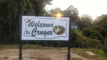
Cruger
 Mayor: Arrica Weatherall
Phone: 662-455-5155
Email: crugertown@bellsouth.net

Cruger is a town in Holmes County, Mississippi, United States. The population was 449 at the 2000 census.
Demographics
As of the census GR2 of 2000, there were 449 people, 161 households, and 112 families residing in the town. The population density was 178.7/km² (462.5/mi²). There were 177 housing units at an average density of 70.5/km² (182.3/mi²). The racial makeup of the town was 25.61% White, 74.16% African American and 0.22% Asian. Hispanic or Latino of any race were 2.23% of the population.
 There were 161 households out of which 33.5% had children under the age of 18 living with them, 32.3% were married couples living together, 30.4% had a female householder with no husband present, and 30.4% were non-families. 29.8% of all households were made up of individuals and 16.1% had someone living alone who was 65 years of age or older. The average household size was 2.79 and the average family size was 3.46.
In the town the population was spread out with 32.1% under the age of 18, 10.0% from 18 to 24, 25.8% from 25 to 44, 15.1% from 45 to 64, and 16.9% who were 65 years of age or older. The median age was 32 years. For every 100 females there were 89.5 males. For every 100 females age 18 and over, there were 77.3 males.
The median income for a household in the town was $15,417, and the median income for a family was $27,500. Males had a median income of $24,375 versus $22,813 for females. The per capita income for the town was $14,125. About 32.8% of families and 44.7% of the population were below the poverty line, including 50.7% of those under age 18 and 58.0% of those age 65 or over.
Geography
Cruger is located at 33°19′15″N, 90°14′6″W (33.320770, -90.234919)GR1.
According to the United States Census Bureau, the town has a total area of 2.5 km² (1.0 mi²), all land.
Durant
 Mayor: John Haynes
Phone: 662-653-3314
Website:
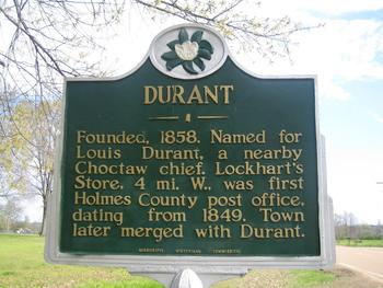
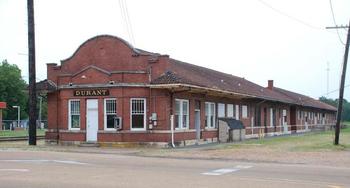
Durant is a city in Holmes County, Mississippi, United States. It was founded in 1858 as a station on the Mississippi Central Railroad, later part of the Illinois Central. Durant was named for Louis Durant, a Choctaw chief, who had lived on a bluff just across the nearby Big Black River. The population was 2,932 at the 2000 census.
Demographics
As of the census GR2 of 2000, there were 2,932 people, 1,075 households, and 744 families residing in the city. The population density was 507.6/km² (1,316.4/mi²). There were 1,209 housing units at an average density of 209.3/km² (542.8/mi²). The racial makeup of the city was 28.79% White, 70.16% African American, 0.14% Native American, 0.31% Asian, 0.07% from other races, and 0.55% from two or more races. Hispanic or Latino of any race were 0.78% of the population.
 There were 1,075 households out of which 35.3% had children under the age of 18 living with them, 35.9% were married couples living together, 30.1% had a female householder with no husband present, and 30.7% were non-families. 28.7% of all households were made up of individuals and 14.3% had someone living alone who was 65 years of age or older. The average household size was 2.68 and the average family size was 3.32.
In the city the population was spread out with 30.9% under the age of 18, 10.2% from 18 to 24, 24.1% from 25 to 44, 18.9% from 45 to 64, and 15.9% who were 65 years of age or older. The median age was 32 years. For every 100 females there were 86.5 males. For every 100 females age 18 and over, there were 72.5 males.
The median income for a household in the city was $19,659, and the median income for a family was $25,065. Males had a median income of $26,500 versus $20,200 for females. The per capita income for the city was $12,210. About 27.9% of families and 35.1% of the population were below the poverty line, including 44.1% of those under age 18 and 26.7% of those age 65 or over.
Geography
Durant is located at 33°4′35″N, 89°51′23″W (33.076313, -89.856405)GR1.
According to the United States Census Bureau, the city has a total area of 5.8 km² (2.2 mi²). 5.8 km² (2.2 mi²) of it is land and 0.1 km² (0.04 mi²) of it (0.89%) is water.
Goodman
 Mayor: Ricky Anderson
Phone: 662-472-2263
citygoodman@bellsouth.net
Goodman is located on the Big Black River, surrounded by the communities of Shady Grove, Georgeville, Richland, Bethlehem, and New Banyon. The area is known for producing cattle, cotton and timber.
Goodman was settled in 1860 and first chartered November 16, 1865 and rechartered March 5, 1878. The town is named for Walter Goodman.
Goodman is the site of the main branch of Holmes Community College (founded 1925.)
Points of interest include the Little Red Schoolhouse and the Goodman School.
In 1891 Goodman was partially destroyed by fire and another devastating fire occurred in 1908, destroying much of the main block on the south side of downtown. Recovery was slow and local citizens who strove to create self-owned businesses spurred business development. According to the United States Census Bureau, the town has a total area of 2.1 km² (0.8 mi²). 2.1 km² (0.8 mi²) of it is land and 1.20% is water.
Demographics
As of the census GR2 of 2000, there were 1,252 people, 280 households, and 206 families residing in the town. The population density was 589.5/km² (1,523.3/mi²). There were 303 housing units at an average density of 142.7/km² (368.7/mi²). The racial makeup of the town was 33.23% White, 65.81% African American, 0.16%
Native American, and 0.80% from two or more races. Hispanic or Latino of any race were 0.64% of the population.
There were 280 households out of which 42.1% had children under the age of 18 living with them, 36.4% were married couples living together, 32.9% had a female householder with no husband present, and 26.4% were non-families. 25.7% of all households were made up of individuals and 9.6% had someone living alone who was 65 years of age or older. The average household size was 2.96 and the average family size was 3.58. In the town the population was spread out with 25.9% under the age of 18, 39.0% from 18 to 24, 18.1% from 25 to 44, 10.1% from 45 to 64, and 6.9% who were 65 years of age or older. The median age was 20 years. For every 100 females there were 103.6 males. For every 100 females age 18 and over, there were 93.3 males. The median income for a household in the town was $13,929, and the median income for a family was $14,643. Males had a median income of $30,000 versus $17,500 for females. The per capita income for the town was $8,359. About 49.0% of families and 45.6% of the population were below the poverty line, including 63.0% of those under age 18 and 35.9% of those ages 65 or over.
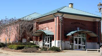
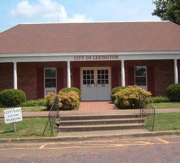
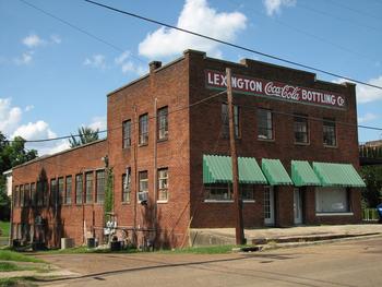
Lexington
 Mayor: Robin McCrory
Phone: 662-834-1261
lexmsone@yahoo.com
Lexington is a city in Holmes County, Mississippi, United States. The population was 2,025 at the 2000 census. It is the county seat of Holmes County.
Demographics
As of the census GR2 of 2000, there were 2,025 people, 725 households, and 503 families residing in the city. The population density was 319.1/km² (825.6/mi²). There were 802 housing units at an average density of 126.4/km² (327.0/mi²). The racial makeup of the city was 31.36% White, 67.26% African American, 0.05% Native American, 0.64% Asian, and 0.69% from two or more races. Hispanic or Latino of any race were 1.98% of the population.
 There were 725 households out of which 30.3% had children under the age of 18 living with them, 37.8% were married couples living together, 26.3% had a female householder with no husband present, and 30.5% were non-families. 28.8% of all households were made up of individuals and 15.4% had someone living alone who was 65 years of age or older. The average household size was 2.70 and the average family size was 3.34.
In the city the population was spread out with 28.5% under the age of 18, 11.1% from 18 to 24, 26.9% from 25 to 44, 17.9% from 45 to 64, and 15.7% who were 65 years of age or older. The median age was 35 years. For every 100 females there were 91.0 males. For every 100 females age 18 and over, there were 83.1 males.
The median income for a household in the city was $22,163, and the median income for a family was $29,732. Males had a median income of $25,750 versus $17,328 for females. The per capita income for the city was $14,614. About 32.7% of families and 37.2% of the population were below the poverty line, including 54.5% of those under age 18 and 28.4% of those age 65 or over.
Geography
Lexington is located at 33°6′52"N, 90°3′4"W (33.114329, -90.051191).
According to the United States Census Bureau, the city has a total area of 6.4 km² (2.5 mi²), all land.
Pickens
 Mayor: Paulette D Moore
Phone: 662-468-2171
pickens@townofpickens.com
Pickens is a town in Holmes County, Mississippi, United States. The population was 1,325 at the 2000 census.
Demographics
As of the census GR2 of 2000, there were 1,325 people, 452 households, and 333 families residing in the town. The population density was 409.3/km² (1,062.3/mi²). There were 496 housing units at an average density of 153.2/km² (397.7/mi²). The racial makeup of the town was 11.92% White, 87.70% African American, 0.08% Native American, 0.08% from other races, and 0.23% from two or more races. Hispanic or Latino of any race were 1.28% of the population.
There were 452 households out of which 34.3% had children under the age of 18 living with them, 34.7% were married couples living together, 33.8% 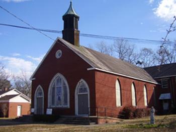 had a female householder with no husband present, and 26.3% were non-families. 24.6% of all households were made up of individuals and 11.1% had someone living alone who was 65 years of age or older. The average household size was 2.93 and the average family size was 3.52.
In the town the population was spread out with 30.9% under the age of 18, 11.2% from 18 to 24, 26.8% from 25 to 44, 19.7% from 45 to 64, and 11.4% who were 65 years of age or older. The median age was 30 years. For every 100 females there were 89.3 males. For every 100 females age 18 and over, there were 81.5 males.
The median income for a household in the town was $17,330, and the median income for a family was $20,956. Males had a median income of $23,750 versus $17,574 for females. The per capita income for the town was $10,812. About 36.1% of families and 40.2% of the population were below the poverty line, including 51.4% of those under age 18 and 41.9% of those age 65 or over.
Geography
Pickens is located at 32°53′12"N, 89°58′12"W (32.886672, -89.970092)GR1.
According to the United States Census Bureau, the town has a total area of 3.4 km² (1.3 mi²). 3.2 km² (1.2 mi²) of it is land and 0.2 km² (0.1 mi²) of it (4.62%) is water.
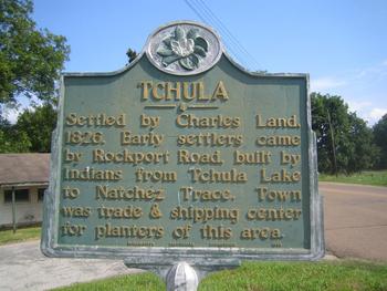
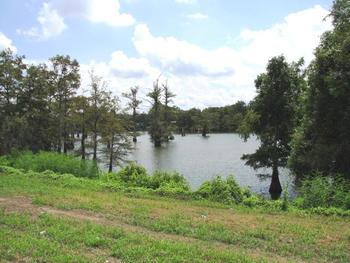
Tchula
 Mayor: Ann Polk
Phone: 662-235-5112
thecityoftchula@bellsouth.net
Tchula is a town in Holmes County, Mississippi, United States. The population was 2,332 at the 2000 census.
Demographics
As of the census GR2 of 2000, there were 2,332 people, 724 households, and 524 families residing in the town. The population density was 647.8/km² (1,683.6/mi²). There were 772 housing units at an average density of 214.4/km² (557.4/mi²). The racial makeup of the town was 3.43% White, 95.93% African American, 0.09% Native American, and 0.56% from two or more races. Hispanic or Latino of any race were 0.47% of the population.
 There were 724 households out of which 38.1% had children under the age of 18 living with them, 21.4% were married couples living together, 45.4% had a female householder with no husband present, and 27.5% were non-families. 25.1% of all households were made up of individuals and 8.8% had someone living alone who was 65 years of age or older. The average household size was 3.22 and the average family size was 3.92.
In the town the population was spread out with 37.9% under the age of 18, 13.0% from 18 to 24, 25.1% from 25 to 44, 14.7% from 45 to 64, and 9.4% who were 65 years of age or older. The median age was 24 years. For every 100 females there were 80.6 males. For every 100 females age 18 and over, there were 71.5 males.
The median income for a household in the town was $11,571, and the median income for a family was $14,773. Males had a median income of $22,250 versus $16,310 for females. The per capita income for the town was $6,373. About 49.4% of families and 54.4% of the population were below the poverty line, including 66.6% of those under age 18 and 55.8% of those age 65 or over.
Geography
Tchula is located at 33°;10′51"N, 90°13′21"W (33.180711, -90.222588)GR1.
According to the United States Census Bureau, the town has a total area of 3.7 km² (1.4 mi²). 3.6 km² (1.4 mi²) of it is land and 0.1 km² (0.04 mi²) of it (2.11%) is water.
West
 Mayor: Sammie Aldridge
Phone: 662-967-2308
townofwest@gmail.com
West is a town in Holmes County, Mississippi, United States. The population was 220 at the 2000 census.
Demographics
As of the census GR2 of 2000, there were 220 people, 94 households, and 64 families residing in the town. The population density was 151.7/km² (394.6/mi²). There were 113 housing units at an average density of 77.9/km² (202.7/mi²). The racial makeup of the town was 56.36% White, 42.73% African American, 0.45% Asian, and 0.45% from two or more races. Hispanic or Latino of any race were 2.27% of the population.
There were 94 households out of which 26.6% had children under the age of 18 living with them, 54.3% were married couples living together, 13.8% had a female householder with no husband present, and 30.9% were non-families. 29.8% of all households were made up of individuals and 20.2% had someone living alone who was 65 years of age or older. The average household size was 2.34 and the average family size was 2.88.
In the town the population was spread out with 22.7% under the age of 18, 7.7% from 18 to 24, 25.9% from 25 to 44, 18.6% from 45 to 64, and 25.0% who were 65 years of age or older. The median age was 40 years. For every 100 females there were 91.3 males. For every 100 females age 18 and over, there were 88.9 males.
The median income for a household in the town was $25,625, and the median income for a family was $45,625. Males had a median income of $22,083 versus $12,396 for females. The per capita income for the town was $18,398. About 14.9% of families and 20.9% of the population were below the poverty line, including 20.9% of those under the age of 18 and 31.2% of those 65 or over.
Geography
West is located at 33°11′50"N, 89°46′45"W (33.197266, -89.779288).
According to the United States Census Bureau, the town has a total area of 1.5 km² (0.6 mi²), all land.